|
杨梦诗 Mengshi Yang 博士, 副教授, 硕士生导师 Email: yangms@ynu.edu.cn Office: Room 1329, School of Earth Science, Yunnan University (办公室:云南大学呈贡校区地球科学学院1329) |
研究兴趣(Research interests):
雷达遥感数据智能处理和地学应用,包括:
(1) 雷达遥感数据处理; SAR/InSAR/极化SAR数据处理方法;时序InSAR分析方法;
(2) 深度学习及机器学习算法在雷达遥感数据中的应用研究;
(3) 雷达遥感城市基础设施健康诊断,包括铁路、建筑物、机场、地铁、水电站等;
(4) 雷达遥感地质灾害监测应用,包括地面沉降、滑坡、地裂缝等;
个人简介(Biographical information):
云南省“兴滇英才”青年引进人才,云南大学“双一流”建设高层次引进人才。主持国家自然科学基金3项,省级科学基金3项,3项国际科学研究合作,参与多项国家级、省级基金以及国际合作项目。目前发表论文30余篇,其中SCI 21篇包括一区顶刊9篇,EI论文6篇(截止2023),在InSAR点目标精密定位与溯源以及形变解译方向有系统性研究,出版英文专著1部。现任中国遥感应用协会女性科技工作者工作委员、云南省地质灾害防治遥感解译识别类专家成员、国际遥感期刊审稿人。2024年获得美国电气和电子工程师协会地球科学与遥感学会(IEEE GRSS)应用地球观测与遥感杂志(J-STARS)最佳审稿人认可。
工作经历 (Research Experience):
§ 2021.06 – 至今 云南大学 地球科学学院 副教授
[Associate Professor, School of Earth Science, Yunnan University]
§ 2019.11 – 2020. 6 香港中文大学 太空与地球信息科学研究所 研究助理
[Research assistant, Institute of Space & Earth Information Science, The Chinese University of Hong Kong]
教育背景(Education Background):
§ 2015.9 – 2020. 9 代尔夫特理工大学,土木工程与地球科学学院,雷达遥感,哲学博士
导师:Ramon F. Hanssen, Paco Lopez-Dekker
[PhD. in Geoscience and Remote Sensing, Civil Engineering and Geosciences, Delft University of Technology, Delft, the Netherlands]
§ 2012.9 – 2020. 6 武汉大学,测绘遥感信息工程国家重点实验室,摄影测量与遥感,工学博士
导师:廖明生 教授
[MPhil-PhD program in Photogrammetry and Remote Sensing, State Key Laboratory of Information Engineering in Surveying, Mapping and Remote Sensing, Wuhan University, Hubei, China]
§ 2008.9 – 2012. 6 中南大学,地球科学与信息物理学院, 测绘工程,工学学士
[B.E. in Geomatics Engineering, Dept. of Geosciences, and Info-Physics, Central South University, Hunan, China]
学术活动(Academic Activities):
· 中国遥感应用协会委员女性科技工作者工作委员
· 云南省地质灾害防治遥感解译识别类专家成员
· IEEE Geoscience and Remote Sensing Magazine, Remote Sensing of Environment, ISPRS Journal of Photogrammetry and Remote Sensing, IEEE Transactions on Geoscience and Remote Sensing, IEEE Journal of Selected Topics on Geoscience and Remote Sensing, International Journal of Applied Earth Observation and Geoinformation, Engineering Geology, International Journal of Digital Earth, Transactions in GIS, Geo-spatial Information Science, IEEE Geoscience and Remote Sensing Letters, International Journal of Remote Sensing, Remote Sensing Letters, Remote Sensing Applications: Society and Environment, Chinese Journal of Electronics, Journal of Applied Remote Sensing, Advances in Space Research, ISPRS International Journal of Geo-Information, Bulletin of Engineering Geology and the Environment, Tunnelling and Underground Space Technology 等国际SCI期刊审稿人
· 《武大学报(信息科学版)》、《雷达学报》、《地理空间信息》、《测绘学报》、《世界地理研究》等中文期刊审稿人
· IEEE International Conference on Signal, Information and Data Processing 2024, 技术委员&专题召集人
· 第一雷达干涉测量学术研讨会2024,组织委员&专题召集人
· IET International Radar Conference 2023(IET国际雷达会议),技术委员&专题召集人
· 2023年第十九届全国数学地质与地学信息学术研讨会,组织委员&专题召集
研究项目(Research Projects):
在研:
· 国家自然科学基金面上项目,42474040,复杂城市场景时序InSAR相干点解码与形变解译方法研究,2025-01至 2028-12, 49万,主持
· 国家自然科学基金专项项目,42442069,2024年08月01日 至2025年12月31日,主持
· 国家自然科学基金青年项目,42101450,面向复杂城市环境的InSAR相干点精密定位与地物关联方法研究,2022-01至2024-12,30万元, 主持
· 云南省“兴滇英才”青年人才引进项目,星载遥感“一带一路”中老铁路沿线潜在形变监测, 2023-01至2027-12年,85万,主持
· 国家重点研发计划子课题,冰冻圈数据制备子课题, 2023-01至-2025-12,参与
· 云南省基础研究计划项目面上项目, 202301AT070145,顾及雷达目标特征的时序InSAR地铁沿线形变分解方法研究,2023-06至2026-05,10万, 主持
· 云南省基础研究计划项目青年项目,202201AU070014, 星载时序InSAR监测西南高填方机场区域的关键技术研究,2022-06至2025-05,5万,主持
· 云南大学“双一流”建设高层人才引进项目, CZ21623201,结合云南地域特色的星载雷达遥感对地观测关键技术研究,2021-06至2027-06,50万,主持
国际合作:
· 欧洲空间局和中华人民共和国科学技术部(ESA-MOST)龙计划6期, ID95473, 2024-06至2028-06,中方PI,
· 德国宇航局(DLR)对地观测项目,MTH3869,2022-09至2024-09,PI
· 日本宇宙局 (JAXA)地球观测项目, ER3A2N106, 2022-04至2024-03, PI
已结题:
· 测绘遥感信息工程国家重点实验室开放基金,21R03,基于InSAR点目标特征描述的地铁沿线形变信号提取与解译方法研究, 2022-01至2023-12, 2024年优秀结题项目,主持
· 云南省地质环境监测院,基于InSAR技术的重点区适用性方法研究,2024年结题,主持
· 香港研资局卓越学科领域,No.AoE/E-603/18,边坡安全中心第一期,524万港币,参与
· 国家重点研发计划, 粤港澳大湾区极端天气气候灾害链的风险管控与应对,子课题三2019YFC1510400,2019年第一期,参与
· 欧洲空间局和中华人民共和国科学技术部(ESA-MOST), 龙计划4,Three- and Four Dimensional Topographic Measurement and Validation (No. 32278), 已结题,参与
· 国家自然科学基金面上项目,41571435,基于高分辨率时间序列InSAR数据分析的桥梁形变监测,2016-01至2019-12,60万元,已结题,参与
· 国家自然科学基金重点项目,61331016,高分辨率SAR图像城市目标认知解译与动态监测应用研究,2014-01至2018-12,245万元,已结题,参与
· 国家973项目课题, 2013CB733205,多源观测数据与滑坡机理模型同化理论与方法研究, 2013至2018,512万元,结题,参与
· 湖北省科学技术厅自然科学基金重点项目,2014CFA047,基于高分辨率 SAR影像监测武汉市地铁沿线表沉降的关键技术,2014-01至2016-12,已结题,参与
· 上海市地质调查研究院,上海市地质沉降及地质环境长期监测,2017.10-2018.9,已结题,参与
论著成果(Selected Publications):
2024
1. Yang, M.; Li, M.; Huang, C.; Zhang, R.; Liu, R. Exploring the InSAR Deformation Series Using Unsupervised Learning in a Built Environment. Remote Sens. 2024, 16, 1375. (2区, IF = 5.78)
https://doi.org/10.3390/rs16081375
2. Yang, M., Li, S., Yu, H., Wu, H., and Li, M.: Revealing Urban Deformation Patterns through InSAR Time Series Analysis with TCN and Transfer Learning, Int. Arch. Photogramm. Remote Sens. Spatial Inf. Sci., XLVIII-1-2024, 813–820, 2024. (ISPRS BEST PAPER AWARD)
https://doi.org/10.5194/isprs-archives-XLVIII-1-2024-813-2024
2023
1. 杨梦诗,廖明生*,常玲,Ramon F. Hanssen. 城市场景时序InSAR 形变解译: 问题分析与研究进展[J]. 武汉大学学报(信息科学版),2023,48(10):1643-1660. (EI, 综述论文)(武汉大学130周年校庆特辑)
https://doi.org/10.13203/j.whugis20230289
2. Mingchun Wen; Mengshi Yang; Xin Zhao; Zhifang Zhao. Post-Construction Deformation Characteristics of High-Fill Foundations of Kunming Changshui International Airport Using Time-Series InSAR Technology. IEEE Journal of Selected Topics in Applied Earth Observations & Remote Sensing,17, 206-218, 2023 (2区,TOP,IF = 4.72)
https://doi.org/10.1109/JSTARS.2023.3328321
3. Li, M.; Yin, X.; Tang, B.-H.; Yang, M*. Accuracy Assessment of High-Resolution Globally Available Open-Source DEMs Using ICESat/GLAS over Mountainous Areas, A Case Study in Yunnan Province, China. Remote Sensing. 2023, 15, 1952. (2区,IF = 5.78) (Editor's Choice Articles) https://doi.org/10.3390/rs15071952
4. Menghua Li, Lu Zhang*, Mengshi Yang, Mingsheng Liao, Complex surface displacements of the Nanyu landslide in Zhouqu, China revealed by multi-platform InSAR observations, Engineering Geology, Volume 317, 2023, 107069, (1区, TOP, IF = 7.4) (ESI高被引论文)
https://doi.org/10.1016/j.enggeo.2023.107069
5. Li M, Wu H, Yang M, Huang C, Tang B-H*. Trend Classification of InSAR Displacement Time Series Using SAE–CNN. Remote Sensing. 2024; 16(1):54. (2区, IF = 5.78)
https://doi.org/10.3390/rs16010054
2022
1. Yang, M., Wang, R., Li, M., Liao, M.. (2022). A PSI targets characterization approach to interpreting surface displacement signals: A case study of the Shanghai metro tunnels, Remote Sensing of Environment, 280,113150. (1区, TOP, IF = 13.8)
https://doi.org/10.1016/j.rse.2022.113150
2. Wang, Ru, Mengshi Yang, Dong Jie, and Mingsheng Liao. (2022). Investigating deformation along metro lines in coastal cities considering different structures with InSAR and SBM analyses,. International Journal of Applied Earth Observation and Geoinformation, 115 (1): 103099. (1区, TOP, IF = 7.672)
https://doi.org/10.1016/j.jag.2022.103099.
3. Wang, Ru, Mengshi Yang, Tianliang Yang, Jinxin Lin, and Mingsheng Liao. (2022). Decomposing and mapping different scales of land subsidence over Shanghai with X- and C-Band SAR data stacks. International Journal of Digital Earth 15 (1):478-502. (1区, TOP, IF = 4.6)
https://doi.org/10.1080/17538947.2022.2036835
4. Wang, J.; Li, M.; Yang, M.; Tang, B.-H. (2022). Deformation Detection and Attribution Analysis of Urban Areas near Dianchi Lake in Kunming Using the Time-Series InSAR Technique. Applied Sciences. 2022, 12, 10004. (3区, IF = 2.4)
https://doi.org/10.3390/app121910004
Before 2022
1. Yang, M. (2020). From Radar to Reality.Associating persistent scatterers to corresponding objects. Delft University of Technology, ISBN: 978-94-6384-128-3. (英文专著)
https://doi.org/10.4233/uuid:1e3cedbf-acf7-412f-9927-25ad5f5f1de3
2. Yang, M., Dheenathayalan, P., López-Dekker, P, Van Leijen F., Liao, M., and Hanssen, R.F. (2020). On the Influence of Sub-pixel Position Correction for PS Positioning accuracy and Time Series Quality, ISPRS Journal of Photogrammetry and Remote Sensing, 165, 98-107. (1区,TOP, IF = 11.77) https://doi.org/10.1016/j.isprsjprs.2020.04.023
3. Yang, M., Dheenathayalan, P., López-Dekker, P, Liao, M., and Hanssen, R.F. (2019). On the value of corner reflectors and surface models in InSAR precise point positioning, ISPRS Journal of Photogrammetry and Remote Sensing. 158,113-122. (1区,TOP, IF = 11.77)
https://doi.org/10.1016/j.isprsjprs.2019.10.006
4. Yang, M., López-Dekker, P, Dheenathayalan, P., Biljecki, F.; Liao, M. and Hanssen, R.F. (2019). Linking Persistent Scatterers to the Built Environment using Ray-Tracing on Urban Models. IEEE Transactions on Geoscience and Remote Sensing. 57(8): 5764-5776. (1区,TOP, IF = 8.12)
https://doi.org/10.1109/TGRS.2019.2901904
5. Yang, M., Yang, T., Zhang, L., Lin, J., Qin, X., Liao, M. (2018) Spatio-Temporal Characterization of a Reclamation Settlement in the Shanghai Coastal Area with Time Series Analyses of X-, C-, and L-Band SAR Datasets. Remote Sensing. 10, 329. (2区, IF = 5.78)
https://doi.org/10.3390/rs10020329
6. 廖明生, 王茹, 杨梦诗*, 王楠, 秦晓琼. (2020). 城市目标动态监测中的时序InSAR分析方法及应用. 《雷达学报》, 9(3): 409-424. (综述, 通讯作者, EI)
http://radars.ie.ac.cn/article/doi/10.12000/JR20022
7. 杨梦诗, 廖明生, 史绪国, 张路. (2017). 联合多平台InSAR 数据集精确估计地表沉降速率场. 《武汉大学学报·信息科学版》, 42(6), 797-802. (EI)
https://doi.org/10.13203/j.whugis20140924
8. 杨梦诗, 廖明生, 秦晓琼, 史绪国. (2017) C 和L 波段SAR 数据在填海新区的应用及特性分析.《武汉大学学报·信息科学版》, 42(9), 1300-1305, (EI)
https://doi.org/10.13203/j.whugis20150356
9. Li, M., Zhang, L., Shi, X., Liao, M., Yang, M. (2019). Monitoring active motion of the Guobu landslide near the Laxiwa Hydropower Station in China by time-series point-like targets offset tracking. Remote Sensing of Environment, 221:80-93. (1区,TOP, IF = 13.8)
https://doi.org/10.1016/j.rse.2018.11.006
10. Wang R., Yang T., Yang, M., Liao, M. (2019) A safety analysis of elevated highways in Shanghai linked to dynamic load using long-term time-series of InSAR stacks. Remote Sensing Letters, 10(12): 1133-1142. (3区)
https://doi.org/10.1080/2150704X.2019.1648903
11. Qin X., Zhang L., Yang M., Luo H., Liao M., and Ding X. (2018). Mapping surface deformation and thermal dilation of arch bridges by structure-driven multi-temporal DInSAR analysis. Remote Sensing of Environment, 71-90. (1区,TOP, IF = 13.8)
https://doi.org/10.1016/j.rse.2018.06.032
12. Qin, X.; Zhang, L.; Ding, X.; Liao, M.; Yang. (2018). M. Mapping and Characterizing Thermal Dilation of Civil Infrastructures with Multi-Temporal X-Band Synthetic Aperture Radar Interferometry. Remote Sens. 10, 941. (2区, IF = 5.78)
https://doi.org/10.3390/rs10060941
13. Qin X, Yang M., Zhang, L., Yang, T., and Liao, M. (2017) Health Diagnosis of Major Transportation Infrastructures in Shanghai Metropolis Using High-Resolution Persistent Scatterer Interferometry. Sensors, 17(12):2770. (3区,IF=4.05)
https://doi.org/10.3390/s17122770
14. Qin X, Liao M, Zhang L, Yang M, et al. (2017) Structural Health and Stability Assessment of High-Speed Railways via Thermal Dilation Mapping With Time-Series InSAR Analysis. IEEE Journal of Selected Topics in Applied Earth Observations & Remote Sensing, 10(6) (3区,IF: 4.72)
https://doi.org/10.1109/JSTARS.2017.2719025
15. Qin, X., Liao, M., Yang, M., et al. (2017) Monitoring structure health of urban bridges with advanced multi-temporal InSAR analysis. Annals of GIS: Geographic Information Sciences, 23(4), 293-302.
16. 王茹, 杨天亮, 杨梦诗, 廖明⽣, 林⾦鑫, 张路(2018). PS-InSAR 技术对上海⾼架路的沉降监测与归因分析. 《武汉⼤学学报·信息科学版》, 43(12): 2050-2057. (EI)
17. 秦晓琼, 杨梦诗, 廖明⽣, 王寒梅,杨天亮(2017),应⽤PSInSAR 技术分析上海道路⽹沉降时空特性,《武汉⼤学学报·信息科学版》,42(2): 170-177. (EI)
18. 秦晓琼, 杨梦诗, 王寒梅, 杨天亮, 林⾦鑫, 廖明⽣(2016). ⾼分辨率PS-InSAR 在轨道交通形变特征探测中的应⽤,《测绘学报》45 (6): 713-721. (EI)
19. 蒋亚楠, 杨梦诗, 廖明⽣, 王寒梅(2013). 应⽤时间序列InSAR 技术监测上海磁悬浮列车专线形变,《上海国⼟资源》,34(4): 17-20.
学术报告 (Presentations)
· 2024-07 第二届城市可持续发展研讨会,昆明 【口头报告】
· 2024-06,2024 Dragon 5 Symposium, Lisbon, Portugal. 【国际会议口头报告】
· 2024-06,第一雷达干涉测量学术研讨会,武汉【国内会议口头报告,专题主持人】
· 2024-05,大地测量与导航2024综合学术年会暨大地测量学科发展研讨会,西安.【国内会议口头报告】
· 2024-05, ISPRS TC I Symposium on Intelligent Sensing and Remote Sensing Application, Changsha, China. 【国际会议口头报告&最佳论文奖】
· 2023-12,首届粤港澳大湾区测绘遥感大会, 珠海. 【国内会议口头报告】
· 2023-12, IET International Radar Conference 2023, Chongqing, China【国际会议专题主持人】
· 2023-11,第六届全国地面沉降防治学术研讨会, 北京. 【国内会议口头报告】
· 2023-04,第十九届全国数学地质与地学信息学术研讨会, 昆明. 【国内会议口头报告,专题主持人】
· 2023-03,“遥感技术创新应用 高端论坛暨专家委员会常务会议, 昆明. 【国内会议口头报告&优秀青年报告】
· 2022-02,《雷达学报》雷达遥感应用学术论坛, 线上. 【邀请报告】
· 2018-11, ICA Symposium on Early Warning and Crises Management in the Big Data Era At: Shenzhen, China 【国际会议报告】
· 2017-06, FRINGE 2017, Helsinki, Finland. 【国际会议口头报告】
· 2016-07, ESA-MOST China Dragon Cooperation: Dragon 3 Final Results and Dragon 4 Kick-off Symposium, Wuhan, China. 【国际会议海报展示】
· 2016-05, ESA Living Planet Symposium, Prague, Czech Republic, 2016. 【国际会议海报展示】
· 2014-11,第二届成像雷达对地观测高级学术研讨会,北京【国内会议口头报告】
· 2014-07, Dragon 3 Mid Term Results, Chengdu, China【国际会议海报展示】
专利 (Patents)
一种地铁沿线形变检测方法、装置、系统以及存储介质 202311422502.9 杨梦诗 杨卓 李梦华 王茹
基于星载SAR 的大梯度滑坡失稳时间预测方法及系统 202310769423.9 李梦华 尹谢宾 唐伯惠 杨梦诗
课程承担(Education and Teaching):
微波遥感(本科生)、合成孔径雷达干涉技术与应用(研究生)、卫星导航与定位(本科生)
地理信息科学导论(本科生)、地球系统科学导论(本科生)
js金沙3983总站培养 (People):
硕士研究生(Graduate Students):
温明淳(国际河流院2021资源环境专业03方向硕士生,毕业去向:中山大学攻博)
李赛伟(国际河流院2022资源环境专业01方向硕士生)
杨 卓(地科院2022地图学与地理信息系统硕士生)
黄一鸣(国际河流院2022资源环境专业03方向硕士生)
喻 航(国际河流院2023资源环境专业01方向硕士生)
俞扬威(国际河流院2023资源环境专业03方向硕士生)
黄委彬(地科院2024地图学与地理信息系统硕士生)
吴 昊(地科院2024地图学与地理信息系统硕士生)
尹 康(地科院2024资源与环境02方向硕士生)
陈思然 (地科院2024资源与环境01方向硕士生)
招生信息(Admission Information):
研究生招生
课题组每年招收2-3名硕士生。简历请投递:yangms@ynu.edu.cn
招生专业一:地图学与地理信息系统 学术型硕士(专业代码07+)
招生专业二:资源与环境工程 专业型硕士(专业代码08+)
欢迎具有地理信息科学、测绘科学、遥感科学、地球物理、空间信息技术、信息与信号处理、电子信息、计算机技术、软件工程、人工智能、大数据、模式识别与智能系统、地质工程、地理学等专业背景同学报考!
本科毕设和本科生科研
每年招收1-2名本科生,做毕业设计或科研训练,毕设一年期间至少参与2次组会。
(2024年8月更新)
js金沙3983总站培养理念(Philosophy for Student Nurturing):
与js金沙3983总站一起成长,一起探索和拓展知识体系。YNU-RADSENS课题组提供完善的科研训练,全方位培养研究生的数据处理与分析、学术报告、论文拟写、项目申请等科研技能和素养。
YNU-RADSENS课题组以优秀科研成果(展现形式为文章、算法、开源代码、专利等)为目标,完善的科研培养体系,与国内外顶尖雷达遥感课题组合作交流密切,为每位同学提供良好的的科研氛围和高水准的科研指导与学术支持,以js金沙3983总站获得更好的发展为团队核心宗旨!
硕士研究生至少参与一次国内外学术交流活动(会议、野外考察等)。有读博意愿的,优秀js金沙3983总站可推荐至武汉大学、中南大学、中山大学、中科院、西工大和国际等知名大学继续深造。
Welcome to Join the Radar Remote Sensing Lab@YNU (YNU-RADSENS).
Please send your CV to yangms@ynu.edu.cn
News ——YNU-RADSENS课题组(Group Activities):

更多日常可以关注课题组github主页:
https://rsyangms.github.io/YNU-RADSENS.github.io/
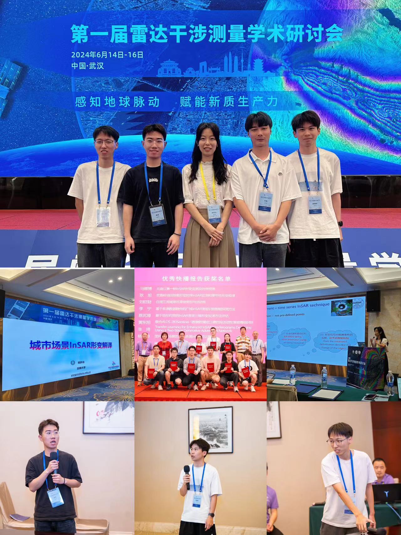
2024年6月课题组参加第一届雷达干涉测量学术研讨会
(杨梦诗,杨卓,喻航,黄委彬,吴昊,武汉)祝贺研究生杨卓获优秀快播报告奖!
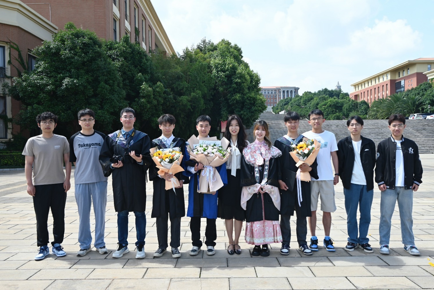
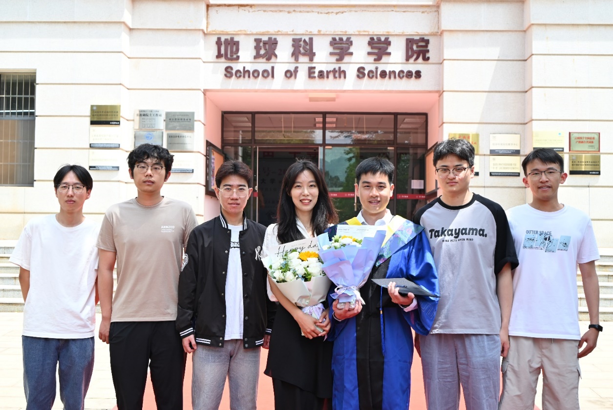
2024年6月毕业季课题组合影
(毕业生:研究生温明淳,本科生黄委彬、吴昊、欧钧杰、宋雨乔)
祝贺研究生温明淳升学中山大学攻读博士,毕业论文答辩优秀。
本科生黄委彬、吴昊升学云南大学,黄委彬、欧钧杰获云南大学优秀毕业论文。
本科生宋雨乔升学香港大学,欧钧杰升学新南威尔士大学。
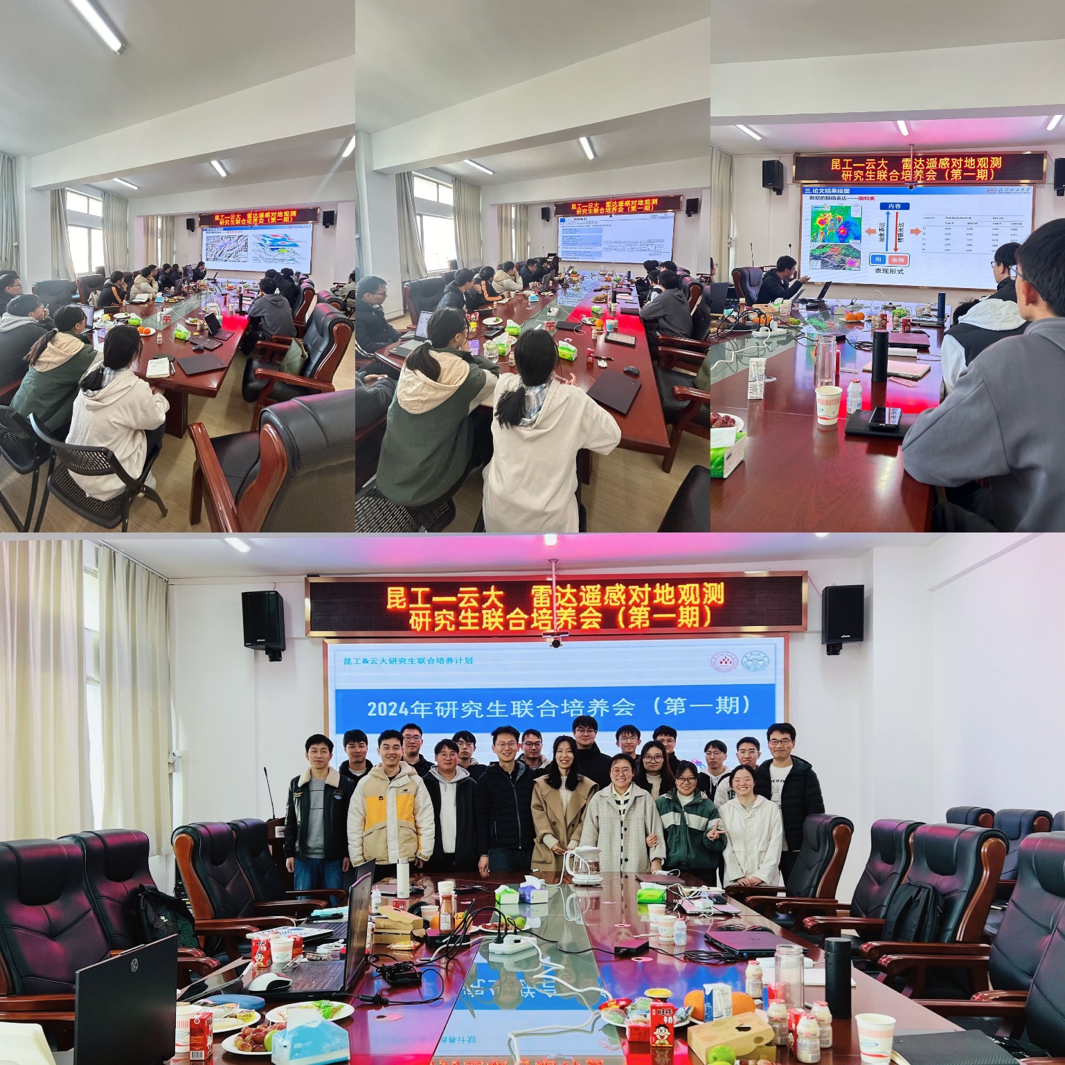
2024年1月课题组与昆工雷达遥感课题组联合培训会(第一期)
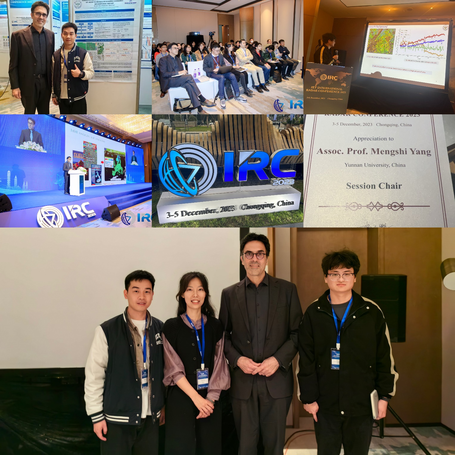
2023年12月课题组在IET-IRC国际雷达大会
(Ramon Hanssen , 杨梦诗,温明淳,李赛伟,重庆)